MapRunF Georeferencing Guide v1.2 Updated May 3rd 2020
Summary
This guide will walk you through the steps to georeference a map using OOM, save it in a format suitable for MapRunF, create a Course using Purple Pen and test a live event using MapRunF.
Guide created using a Windows 10 PC with OOM 0.9.2, Purple Pen 3.3.0 and Google Earth Pro v7.3.2.5776
Prep
Ensure OOM (Mapper) is installed (https://www.openorienteering.org/apps/mapper/)
Ensure Purple Pen is installed (http://purplepen.golde.org/)
Ensure Google Earth Pro is installed (https://www.google.com/earth/versions/#earth-pro)
(all of these apps are free)
1. Get a copy of your non-georeferenced .OCAD base map file from the club archives
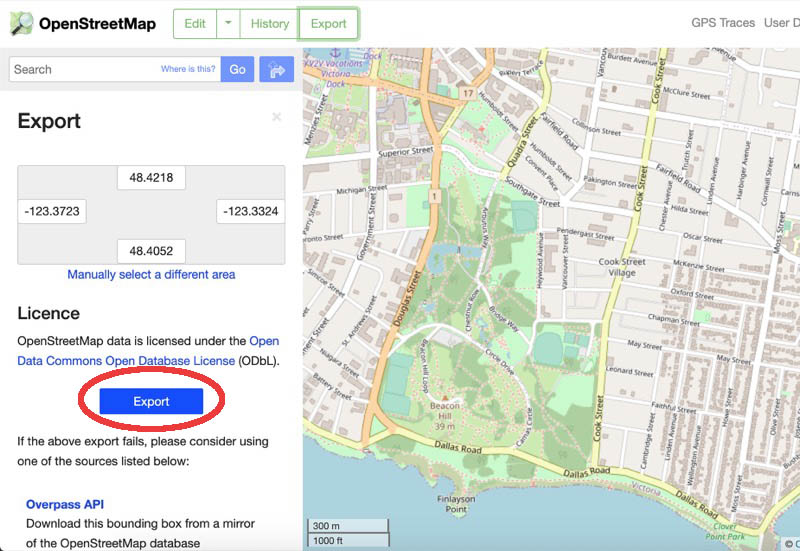
2. Go to OpenStreetMap.org, find the general area of the map you want, zoom out to see it all then click export.

3. Click the Blue Export button to save this as an OSM file